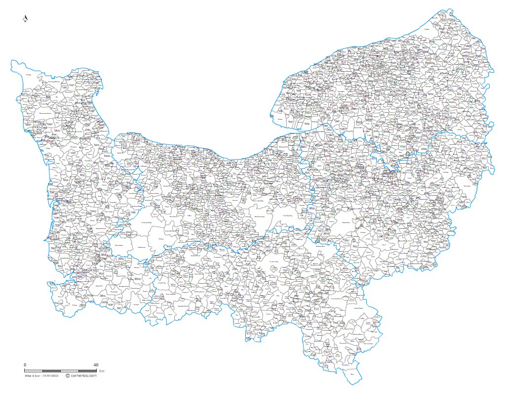
Liste des villes et communes de Normandie
Liste complète des communes, cantons, intercommunalités, population de Normandie.
Mise à jour permanente.
Mise à Jour : La région de Normandie comporte 181 communes nouvelles :
Valambray, Aurseulles, Colomby-Anguerny, Les Monts d'Aunay, Balleroy-sur-Drôme, Malherbe-sur-Ajon, Souleuvre-en-Bocage, Thue et Mue, Cambremer , Caumont-sur-Aure, Cesny-les-Sources , Condé-en-Normandie, Creully sur Seulles, Formigny La Bataille, Isigny-sur-Mer, Dialan sur Chaîne, Laize-Clinchamps, Ponts sur Seulles, Terres de Druance, Livarot-Pays-d'Auge, Moulins en Bessin, Saint-Martin-de-May, Méry-Bissières-en-Auge, Mézidon Vallée d'Auge, Moult-Chicheboville, Notre-Dame-d'Estrées, Val d'Arry, Val d'Arry, Pont-l’Évêque , Belle Vie en Auge, Castine-en-Plaine , Rots, Le Castelet , Valorbiquet, Val-de-Vie, Seulline, Seulline, Aure sur Mer, Saint-Pierre-en-Auge, Noues de Sienne, Val de Drôme, Le Hom, Montillières-sur-Orne , Valdallière, La Vespière-Friardel, Victot-en-Auge, Vire-Normandie, Amfreville-Saint-Amand, Le Val-d'Hazey, Chambois, Mesnil-en-Ouche, Les Monts du Roumois, Frenelle-en-Vexin , Flancourt-Crescy-en-Roumois, Thenouville, le Bosroumois, Grand-Bourgtheroulde, Bourneville-Sainte-Croix, Breteuil, Marbois, Clef-Vallée-d'Eure, Mesnils-sur-Iton , Mesnils-sur-Iton , Vexin-sur-Epte, Le Perrey , La Baronnie, Goupil-Othon, Val d'Orger, Le Bosc-du-Theil, Terres de Bord, Nassandres-sur-Risle, Le Val-Doré, Pacy-sur-Eure, Pont-Audemer, Porte-de-Seine, Treis-Sants-en-Ouche , Le Mesnil-Saint-Jean , La Chapelle-Longueville, Le Lesme, Sainte-Marie-d'Attez, Le Thuit-de-l'Oison, Les Trois Lacs, Verneuil d'Avre et d'Iton, La Vieille-Lyre , Sylvains-les-Moulins, Avranches , La Hague, Bricquebec-en-Cotentin, Buais-les-Monts, Canisy, Carentan-les-Marais , Carentan-les-Marais , Le Grippon, Cherbourg-en-Cotentin, Condé-sur-Vire, Vicq-sur-Mer, Ducey-les-Chéris, Gavray-sur-Sienne , Gonneville-le-Theil, Gouville-sur-Mer , la Haye, Thèreval, Juvigny les Vallées, Lessay, Tourneville-sur-Mer, Montsenelle, Marigny-le-Lozon, Mortain-Bocage, Moyon-Villages, Orval-sur-Sienne, Grandparigny, Percy-en-Normandie, Picauville, Pont-Hébert, Pontorson, Port-Bail-sur-Mer , Quettehou , Quettreville-sur-Sienne , Remilly-les-Marais, Romagny-Fontenay, Saint-Amand-Villages, Saint-Hilaire-du-Harcouët, Saint-James, Saint-Jean-d'Elle, Sainte-Mère-Église , Le Parc, Bourgvallées , Bourgvallées , Saint-Sauveur-Villages , Terre-et-Marais, Sartilly-Baie-Bocage, Sourdeval, le Teilleul, Tessy-Bocage, Tirepied-sur-Sée , Torigny-les-Villes, Villedieu-les-Poêles-Rouffigny, Athis-Val-de-Rouvre, Cour-Maugis-sur-Huisne, Chailloué, Rives-d'Andaine, Sablons-sur-Huisne, Domfront-en-Poiraie, Écouché-les-Vallées, La Ferté-en-Ouche, la Ferté-Macé, Monts-sur-Orne, Belforêt-en-Perche, Juvigny-Val-d'Andaine, L'Orée-d'Écouves , Longny-les-Villages, Merlerault-le-Pin, Montsecret-Clairefougère, Mortrée , Perche-en-Nocé, Passais-Villages, Putanges-le-Lac, Écouves, Rémalard-en-Perche, Boischampré, Charencey, Sap-en-Auge, Les Monts-d'Andaine, Gouffern en Auge, Bagnoles-de-l'Orne-Normandie, Bagnoles-de-l'Orne-Normandie, Val-au-Perche, Tinchebray-Bocage, Tourouvre-au-Perche, Val-de-Scie , Les Hauts-de-Caux , Bois-Guillaume-Bihorel, Buchy, Rives-en-Seine, Terres-de-Caux, Forges-les-Eaux, Saint-Martin-de-l'If, Arelaune-en-Seine, Morville-le-Héron, Port-Jérôme-sur-Seine et Petit-Caux.
Liste des 2655 villes et communes de Normandie au 1er janvier 2026
| nom | cp  |
arrdt | canton | EPCI | pop | lat. | long. | alti | surf |
|---|---|---|---|---|---|---|---|---|---|
| Villers-sur-le-Roule | 27940 | 1 | Gaillon | CA Seine-Eure | 841 | 49.19556 | 1.32806 | 70 | 4.27 |
| Port-Mort | 27940 | 1 | Les Andelys | CA Seine Normandie Agglomération | 891 | 49.16833 | 1.40694 | 16 | 12.19 |
| Les Trois Lacs | 27940 | 1 | Gaillon | CC Eure-Madrie-Seine | 49.19972 | 1.29583 | 120 | 15.01 | |
| Le Val-d'Hazey | 27940 | 1 | Gaillon | CA Seine-Eure | 5156 | 49.16861 | 1.33194 | 23 | 7.95 |
| Mercey | 27950 | 1 | Pacy-sur-Eure | CA Seine Normandie Agglomération | 56 | 49.07889 | 1.39306 | 130 | 3.62 |
| Sainte-Colombe-près-Vernon | 27950 | 1 | Pacy-sur-Eure | CA Seine Normandie Agglomération | 310 | 49.09389 | 1.33806 | 130 | 2.70 |
| Saint-Vincent-des-Bois | 27950 | 1 | Pacy-sur-Eure | CA Seine Normandie Agglomération | 338 | 49.07000 | 1.40056 | 142 | 5.36 |
| Villez-sous-Bailleul | 27950 | 1 | Pacy-sur-Eure | CA Seine Normandie Agglomération | 318 | 49.11000 | 1.37750 | 100 | 4.44 |
| la Heunière | 27950 | 1 | Pacy-sur-Eure | CA Seine Normandie Agglomération | 454 | 49.06028 | 1.41417 | 130 | 3.07 |
| La Chapelle-Longueville | 27950 | 1 | Pacy-sur-Eure | CA Seine Normandie Agglomération | 3283 | 49.10806 | 1.44194 | 25 | 4.56 |
| Saint-Marcel | 27950 | 1 | Pacy-sur-Eure | CA Seine Normandie Agglomération | 4474 | 49.09555 | 1.44667 | 50 | 9.98 |
| Baudre | 50000 | 4 | Saint-Lô-2 | CA Saint-Lô Agglo | 595 | 49.09056 | -1.07167 | 70 | 3.83 |
| Saint-Lô [3] | 50000 | 4 | Saint-Lô | CA Saint-Lô Agglo | 19352 | 49.11389 | -1.09194 | 30 | 23.29 |
| Saint-Georges-Montcocq | 50000 | 4 | Pont-Hébert | CA Saint-Lô Agglo | 983 | 49.13028 | -1.09389 | 98 | 9.21 |
| Rampan | 50000 | 4 | Pont-Hébert | CA Saint-Lô Agglo | 227 | 49.13972 | -1.14778 | 10 | 4.15 |
| le Mesnil-Rouxelin | 50000 | 4 | Pont-Hébert | CA Saint-Lô Agglo | 470 | 49.14944 | -1.08528 | 90 | 4.76 |
| Cherbourg-en-Cotentin | 50100 | 2 | Cherbourg-en-Cotentin | CA du Cotentin | 78028 | 49.64167 | -1.62639 | 19 | 8.59 |
| Bretteville | 50110 | 2 | Cherbourg-en-Cotentin-5 | CA du Cotentin | 1006 | 49.65528 | -1.52667 | 25 | 5.79 |
| Digosville | 50110 | 2 | Cherbourg-en-Cotentin-5 | CA du Cotentin | 1665 | 49.63222 | -1.52528 | 110 | 9.42 |
| le Mesnil-au-Val | 50110 | 2 | Cherbourg-en-Cotentin-5 | CA du Cotentin | 727 | 49.60611 | -1.52389 | 109 | 13.59 |
| Romagny-Fontenay | 50140 | 1 | Le Mortainais | CA Mont-Saint-Michel-Normandie | 1247 | 48.64250 | -0.96556 | 155 | 29.47 |
| Mortain-Bocage | 50140 | 1 | Le Mortainais | CA Mont-Saint-Michel-Normandie | 2954 | 48.65028 | -0.93944 | 220 | 7.41 |
| Saint-Clément-Rancoudray | 50140 | 1 | Le Mortainais | CA Mont-Saint-Michel-Normandie | 548 | 48.67639 | -0.88750 | 272 | 32.77 |
| Saint-Barthélemy | 50140 | 1 | Le Mortainais | CA Mont-Saint-Michel-Normandie | 338 | 48.68417 | -0.95194 | 290 | 6.90 |
| le Neufbourg | 50140 | 1 | Le Mortainais | CA Mont-Saint-Michel-Normandie | 399 | 48.65528 | -0.94639 | 230 | 2.22 |
| Chaulieu | 50150 | 1 | Le Mortainais | CA Mont-Saint-Michel-Normandie | 287 | 48.73500 | -0.86056 | 360 | 10.58 |
| Sourdeval | 50150 | 1 | Le Mortainais | CA Mont-Saint-Michel-Normandie | 3040 | 48.72445 | -0.91889 | 220 | 36.99 |
| Brouains | 50150 | 1 | Le Mortainais | CA Mont-Saint-Michel-Normandie | 140 | 48.72306 | -0.96750 | 200 | 3.83 |
| Perriers-en-Beauficel | 50150 | 1 | Le Mortainais | CA Mont-Saint-Michel-Normandie | 207 | 48.73833 | -0.99611 | 260 | 9.28 |
| Beauficel | 50150 | 1 | Le Mortainais | CA Mont-Saint-Michel-Normandie | 119 | 48.74194 | -0.95889 | 260 | 9.14 |
| Gathemo | 50150 | 1 | Le Mortainais | CA Mont-Saint-Michel-Normandie | 268 | 48.76583 | -0.97444 | 330 | 10.56 |
| Torigny-les-Villes | 50160 | 4 | Condé-sur-Vire | CA Saint-Lô Agglo | 4441 | 49.03556 | -0.97889 | 80 | 3.06 |
| le Perron | 50160 | 4 | Condé-sur-Vire | CA Saint-Lô Agglo | 193 | 49.05305 | -0.90444 | 130 | 4.72 |
| Saint-Amand-Villages | 50160 | 4 | Condé-sur-Vire | CA Saint-Lô Agglo | 2523 | 49.04278 | -0.96583 | 136 | 29.38 |
| Biéville | 50160 | 4 | Condé-sur-Vire | CA Saint-Lô Agglo | 196 | 49.08444 | -0.88778 | 100 | 5.61 |
| Lamberville | 50160 | 4 | Condé-sur-Vire | CA Saint-Lô Agglo | 167 | 49.08750 | -0.90833 | 128 | 7.17 |
| Pontorson | 50170 | 1 | Pontorson | CA Mont-Saint-Michel-Normandie | 4319 | 48.55722 | -1.50833 | 10 | 43.26 |
| Aucey-la-Plaine | 50170 | 1 | Pontorson | CA Mont-Saint-Michel-Normandie | 413 | 48.52861 | -1.47722 | 20 | 9.56 |
| Tanis | 50170 | 1 | Pontorson | CA Mont-Saint-Michel-Normandie | 273 | 48.59333 | -1.43861 | 18 | 7.48 |
| Servon | 50170 | 1 | Pontorson | CA Mont-Saint-Michel-Normandie | 257 | 48.60250 | -1.41722 | 30 | 9.23 |
| Sacey | 50170 | 1 | Pontorson | CA Mont-Saint-Michel-Normandie | 512 | 48.51083 | -1.44917 | 30 | 15.35 |
| le Mont-Saint-Michel | 50170 | 1 | Pontorson | CA Mont-Saint-Michel-Normandie | 23 | 48.63639 | -1.51028 | 9 | 3.99 |
| Huisnes-sur-Mer | 50170 | 1 | Pontorson | CA Mont-Saint-Michel-Normandie | 168 | 48.60944 | -1.45139 | 20 | 6.84 |
| Beauvoir | 50170 | 1 | Pontorson | CA Mont-Saint-Michel-Normandie | 435 | 48.59694 | -1.50306 | 20 | 14.41 |
| Agneaux | 50180 | 4 | Saint-Lô-1 | CA Saint-Lô Agglo | 4266 | 49.11639 | -1.11250 | 60 | 6.55 |
| Thèreval | 50180 | 4 | Saint-Lô-1 | CA Saint-Lô Agglo | 1781 | 49.12778 | -1.16583 | 75 | 13.65 |
| Saint-Gilles | 50180 | 4 | Saint-Lô-1 | CA Saint-Lô Agglo | 987 | 49.10361 | -1.17417 | 100 | 7.88 |
| Périers | 50190 | 3 | Agon-Coutainville | CC Côte Ouest Centre Manche | 2355 | 49.18750 | -1.40750 | 26 | 14.55 |
| Gonfreville | 50190 | 3 | Agon-Coutainville | CC Côte Ouest Centre Manche | 162 | 49.23917 | -1.39333 | 21 | 9.19 |
| Gorges | 50190 | 3 | Agon-Coutainville | CC Côte Ouest Centre Manche | 347 | 49.25722 | -1.40667 | 15 | 22.88 |
Source: Insee.fr
[ 3 ] commune chef-lieu de département
[ 4 ] commune chef-lieu de région
Carte des villes et communes de Normandie
Carte personnalisable des communes de Normandie, imprimable grand format. Voir cette carte